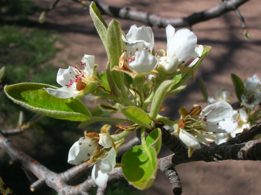
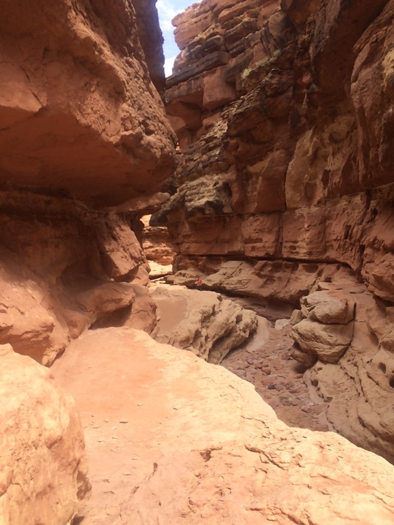
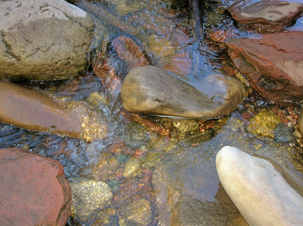
During my first extended visit to Northern Arizona, it stole my heart. It was early springtime, and the trees were budding and blooming and releasing sublime fragrances. The hiking trails were numerous, and lined with boulders, multi-colored sandstone, red cliffs, huge ponderosa pine trees, alligator junipers, small cactus shrubs, and aspen groves. Some trails featured Native American cliff dwellings, mud-walled structures, and petroglyphs. Other trails crossed creeks or lead to lakes, big and small. The most interesting trail I hiked, Cathedral Wash (a workout for both body and mind due to the trail dropping between 5 and 30 feet in areas, leaving you to figure out how to descend) ends at the Colorado River, just outside the Grand Canyon.
I find that a great number of people are unaware of Arizona’s elevation changes, the presence of trees, and the dramatic climate differences in the state. If you think of a featureless, sandy, flat state with no water, trees, flowers, or beauty when you hear someone speak of Arizona, this post is for you.
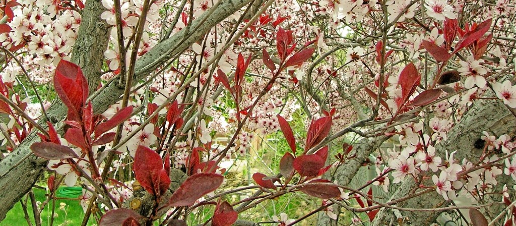
You may have heard of the lovely red rocks of Sedona. Before beginning my 3-year road-trip adventure years ago, friends suggested I visit Sedona due to its incredible beauty and reputation as a spiritual hub. I took that advice, and they were right: its splendor is unforgettable, and with a guide, I was able to access a remote area that felt very sacred. But, did you know that Sedona sits at 4000 feet above sea level? And that it has a big, beautiful creek running through it, much of it recreation-accessible? (See this post for more on that.) During the late fall and early winter, trees along the creek turn spectacular shades of red, orange, and yellow. When snow falls on the red rocks, the sight is nothing short of glorious.

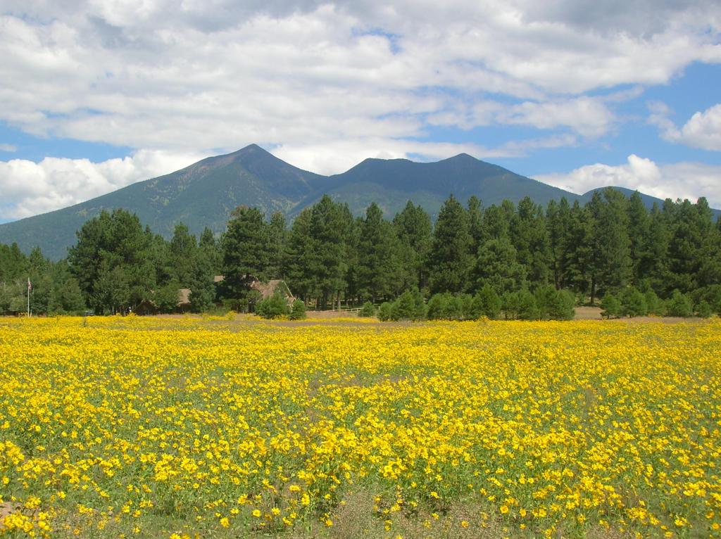
Speaking of snow, the highest point in the state, Humphreys Peak, topping out at 12,633 feet in elevation, sits among The San Francisco Peaks to the north of the small town of Flagstaff. At about 7000 feet above sea level, Flagstaff is one of the snowiest areas in the country, getting an average of 100 inches annually. Each of the seasons could not be more beautiful in Flag, as the locals call it. After winter covers Humphreys Peak with a bright white blanket, a lovely springtime arrives, bringing with it happy meadowlarks, woodpeckers, blue jays, hummingbirds, wrens, robins, warblers, finches, sparrows, and juncos. When summer takes over, there are a couple weeks of 90+ degree temps, but most days are cooler. It is possible during the summer to need a jacket at night, as high desert summer temps can drop into the 40s. Beginning around the first week in July, the area gets super-saturated with rain as a result of monsoon season, which lasts through September. The heavy precipitation encourages a myriad of wildflowers to pop up in meadows & canyons, alongside roads, and on hiking trails, once again transforming the beauty of the little mountain town. And then, fall arrives, causing local leaves to sing with vibrant colors.
The drive north from Flagstaff reveals an other-worldly topography. Most of the land in the northeast corner of the state belongs to Navajo Nation and is largely undeveloped. About 90 minutes north of Flagstaff, you will see the turn-off to the Grand Canyon, which is a must-see. Carved by the Colorado River over millions of years, the Canyon is immense, sporting an elevation change of 8000 feet between its highest point and the mighty Colorado.

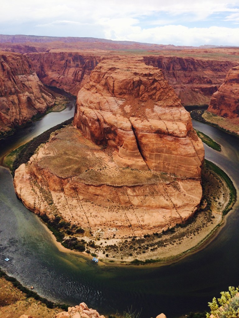
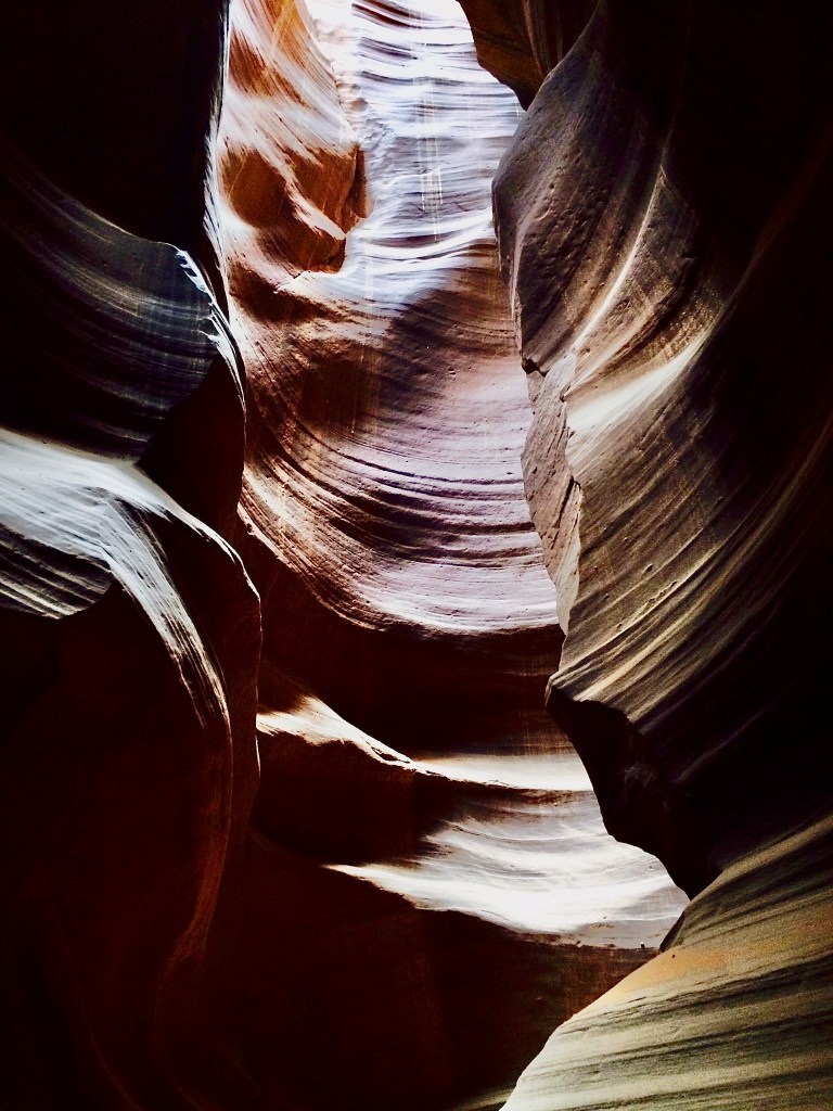
About an hour farther north, you will discover Horseshoe Bend, Lake Powell, and Antelope Canyon. A boat tour on Lake Powell (located in both Arizona and Utah) offers spectacular views of the red, orange and white sandstone cliffs surrounding the water. With a Navajo guide, a walk through the narrow, beautifully formed Antelope Canyon will astonish you. The slot canyons are the happy result of flash floods having eroded the soft sandstone.
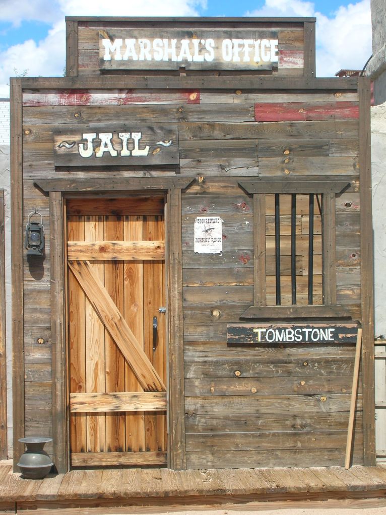
As for points farther south, you will find them uniquely interesting as well. A drive south on I-17 just north of Phoenix yields a plethora of saguaro cactus plants at a certain point, and although I’ve yet to witness it, I’m told their beauty is astounding when they’re all in bloom. Tombstone, made famous by outlaws like Wyatt Earp and Doc Holliday, is a cool little town where gunfight reenactments are performed in the unpaved streets. It has been designated one of the best-preserved rugged frontier towns of the late 1800s. And Tucson offers an extensive Botanical Gardens network, Saguaro National Park, and Mt. Lemmon, a jewel that rises over 9000 feet out of the Sonoran Desert.
If you have always pictured the state of Arizona as hot, sandy, and drab, I hope this post has forever changed that image. The state’s diverse and distinctive terrain is an eye-popping Mecca for outdoor enthusiasts. Experience its unique history and allure, and you may find yourself writing love notes, as well.
Blessings for Arizona Beauty,
Lisa
Note: My beloved state is currently aflame. At the time of this post, there are more than 130 fires burning around the state; the largest 7 encompass over 400,000 acres, and many of the fires continue to grow. If you plan to visit Arizona this year, I strongly advise that you wait until the fires have subsided and air quality has improved.
Comments have been turned off for this post.
The original version of this post, entitled Arizona: A Love Letter, was published in May of 2020.
The content of this article is for educational and informational purposes only, and is not intended as medical advice. Please consult with a qualified health care professional before acting on any information presented herein. Any statements about the possible health benefits of any subject discussed have not been evaluated by medical professionals or the Food & Drug Administration and are not intended to diagnose, treat, cure or prevent any disease or illness.

